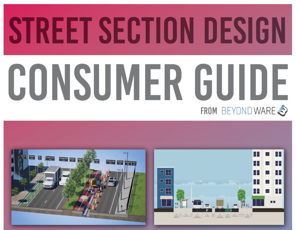
Background - Comparing 10 street section creation alternatives
Designing roads using cross-sections is a common practice in the field of civil engineering, as it allows professionals to plan and visualize the layout and functionality of a roadway in detail. There are many different methods for designing roads using cross-sections, each with its own benefits and limitations. In this guide, we will compare a variety of different methods for designing roads using cross sections, including multi-tool workflows, computer-aided design (CAD) software, 2D web creators, our own Beyond Typicals and more.
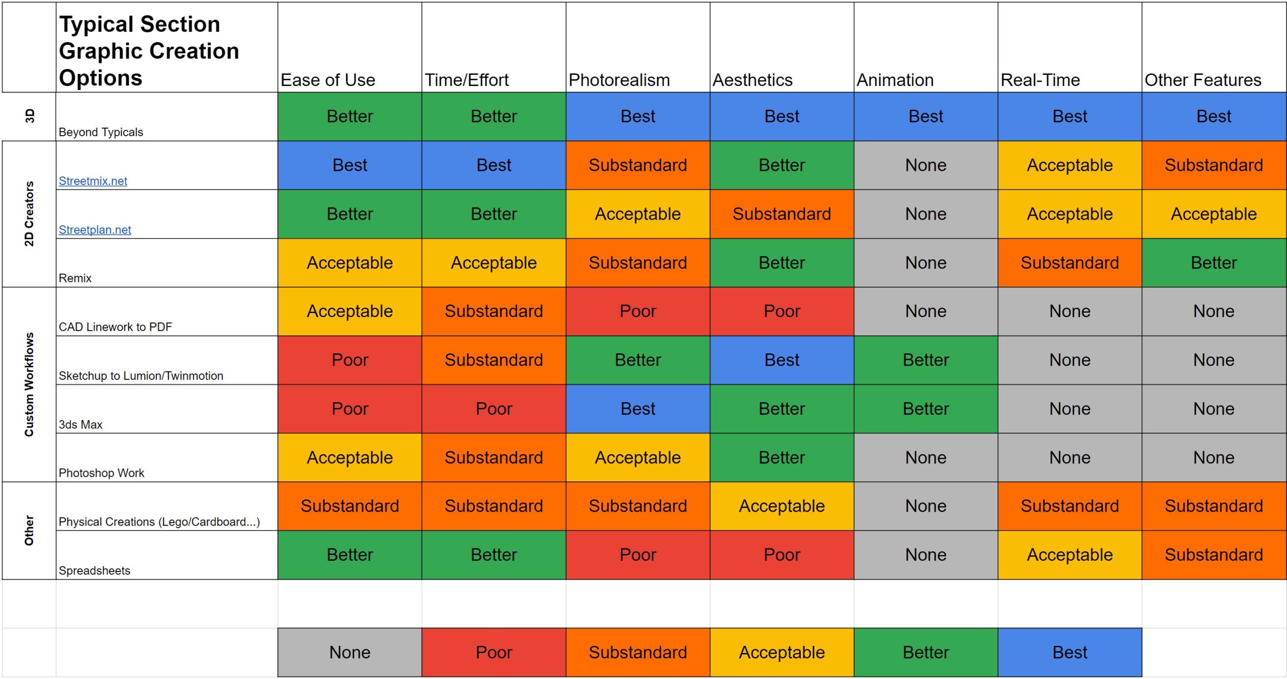
By comparing these 10 methods, we aim to provide a comprehensive overview of the different options available to professionals working in the field of road design, and to help you choose the best method for your specific needs and goals.
We’ve separated these options into 4 different categories: 3D section creators, 2D section creators, custom workflows and other. This guide will first review each of these categories and options, and then conclude by comparing all 10.
We have decades of experience in civil engineering and 3D visualization and have used our expertise in combination with in-depth research to find the best possible (but non-comprehensive) list of options available to design roads and streets using cross-sections.
1- 3D Section Creators
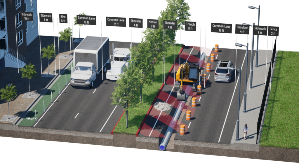
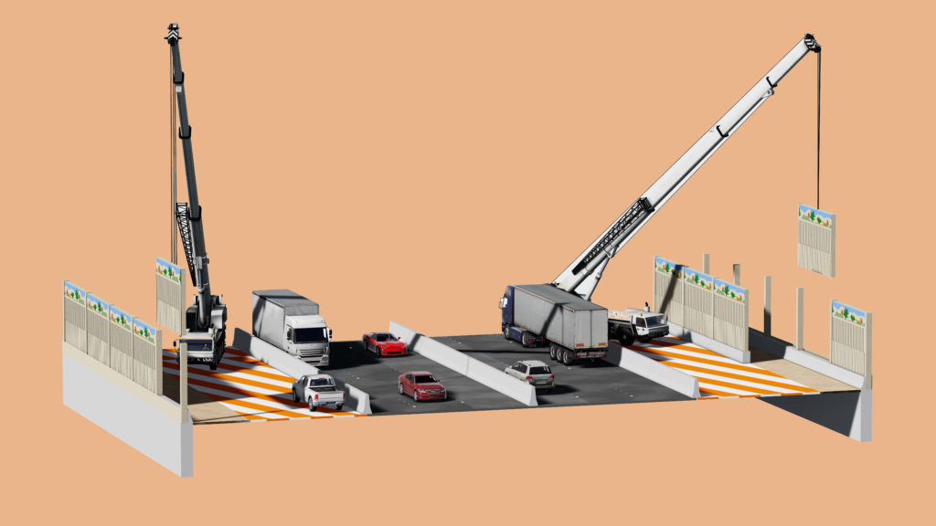
For now, this is a category of one. Beyond Typicals (developed and published by our Beyond CAD team) was launched in early 2022 and has quickly become the tool of choice for engineering firms, public agencies and contractors looking to quickly and accurately communicate their projects. Users can create road sections in minutes by dragging and dropping pre-made sections and adjusting them with textures, assets, labels and more. What was previously only possible using complex software workflows and expert artists is now possible for almost anyone.
Options: Beyond Typicals
Pros: Ease of use, realism, aesthetics, real-time editing and animation, phasing, bridge design and other features
Cons: PC download and graphics card may be limiting for some users. Pro license required for all features.
2- 2D Section Creators
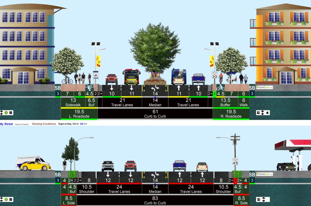
These are browser-based applications that allow users to design their own virtual streets by dragging 2D sections and choosing from a variety of options such as lane widths, types of pavement, and types of street furniture. Users can create a street layout that reflects their desired vision for a particular location, and can then share their designs with others. These 2D creators are intended to be used as tools for urban planning, and are meant to facilitate discussions about the design and use of streets in cities and towns. They can be used by anyone who is interested in creating more livable, walkable, and sustainable communities.
Options: Streetmix, Streetplan, Remix, and our own StreetDesignAI
Pros: Ease of use, no download necessary, free options available, real-time editing
Cons: Lack of realism and customization, limited to 2D, lack of features beyond basic functionality
3- Custom Workflows
These workflows can be used to create realistic and visually appealing designs, which can help to communicate your ideas effectively to others. This can be especially important when presenting your street design to stakeholders or decision-makers, as a well-designed and visually compelling presentation can help to convey the benefits and value of your design. Also, 3D modeling and visualization software can be used to create interactive 3D simulations, which can be useful for testing and analyzing different design scenarios, and for optimizing the layout and functionality of your streets. The major downside of these workflows are that they can be very costly and only available for experienced and trained 3D artists and teams.
Options: CAD linework to PDF, Sketchup to Lumion/Twinmotion, 3ds Max, Photoshop and others
Pros: Some of the best photorealism and animation can be achieved, very customizable
Cons: Can be very expensive and time-consuming, end results may not be editable in real-time
4- Other Options
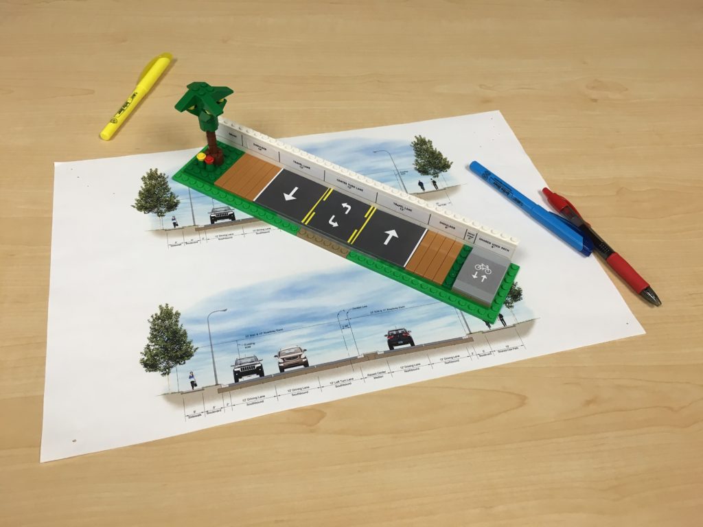
While working in this industry for many years, we’ve come across some creative methods of designing streets using sections. One of the more useful and popular methods includes using a simple spreadsheet. Spreadsheets can be useful tools for designing streets using sections because users can enter the size and shape of the street sections, as well as any other relevant information such as the width of the roadway, the type of pavement, and the location of street furniture. Users may also be able to include data on the volume of traffic on the street, as well as the types of vehicles that use it for analysis of the design across several disciplines. Physical creations such as cardboard or Lego have also been used successfully to communicate project designs, especially at in-person public meetings.
Options: Spreadsheets, physical creations
Pros: Spreadsheets are easy to use and edit, physical creations are tactile and interesting
Cons: Not as realistic or aesthetically pleasing, may not be viable options for many projects.
Comparison
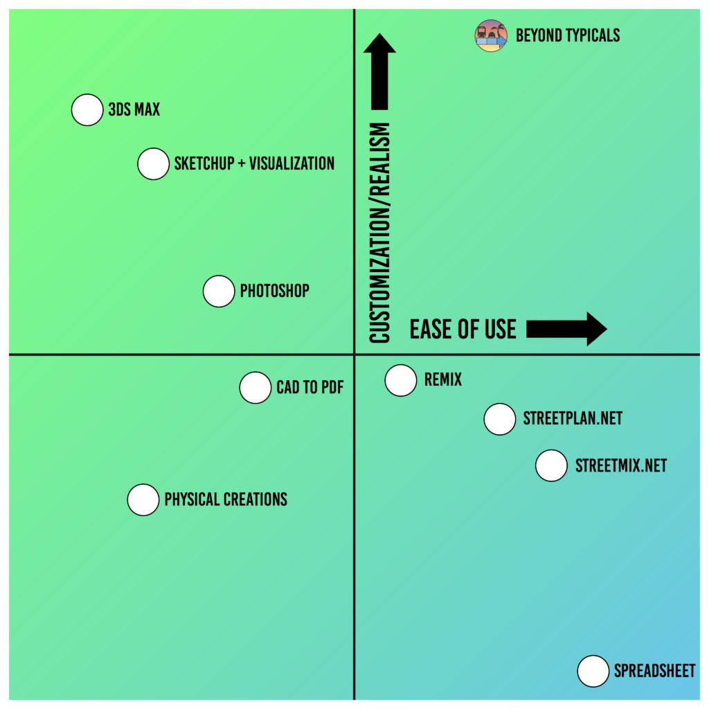
Most of these street section design options find success in either ease of use or customization/realism, but not both. Beyond Typicals stands out as an exception with its low learning curve while also offering high-end graphics and customization.
Honorable Mention
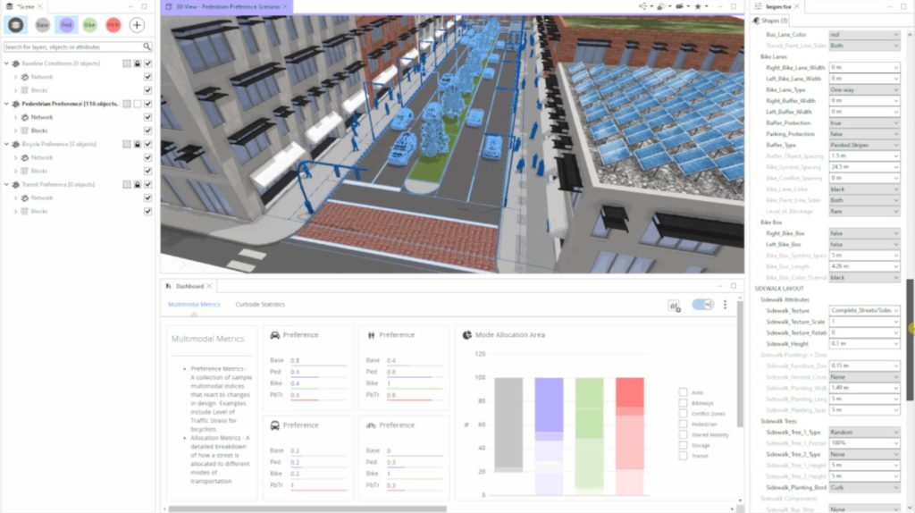
Beyond Typicals user David Wasserman submitted another tool for street design for consideration in this discussion- City Engine. Because it isn’t strictly a section creator, it hasn’t been included above, but because it is similar and so useful, it has been included as an honorable mention.
Conclusion
Learning and comparing these 10 options for street design using sections is valuable across several metrics.
First, using typical sections remains a vital component of design, decision-making and communication in transportation.
Second, there are a number of options available to evaluate and use, depending on the team and project.
And finally, for those most serious about rapid design and communication of their transportation projects, Beyond Typicals has been specifically built for this purpose. We have deliberately worked to combine the ease of use of the 2D web creators with the realism and aesthetics of complex 3D design workflows. Combining the real-time adjustments, phasing and other features, it is clear why Beyond Typicals is quickly becoming the visualization and planning tool of choice for engineering firms, public agencies
and contractors throughout the world.
Learn more about Beyond Typicals here, or schedule a demo with our team from our Contact page.

